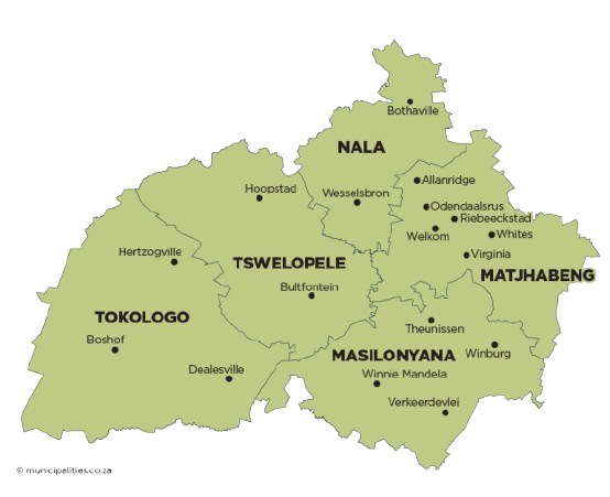
Tokologo Local Municipality is located within the Lejweleputswa District in the western Free State Province. It borders the North West Province to the north, Xhariep District to the south, Tswelopele and Masilonyana Local Municipalities to the east, and the Northern Cape Province to the west.
The municipality covers approximately 9 326 km² and includes the towns of Boshof, Dealesville and Hertzogville, as well as a portion of the former Transitional Rural Council known as Moddervaal, which includes approximately 1 480 farms. Boshof, the capital town, is centrally located, with Dealesville to the east and Hertzogville to the north.
The name Tokologo, a Setswana word meaning “freedom”, reflects the historic struggle of South Africans and the attainment of democracy on 27 April 1994. The municipality’s economy is primarily driven by agriculture, supported by sectors such as trade, community services, manufacturing, and mining.