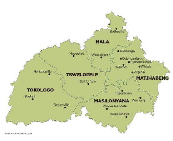
Tokologo Local Municipality is located within the Lejweleputswa District in the western Free State Province. It borders the North West Province to the north, Xhariep District to the south, Tswelopele and Masilonyana Local Municipalities to the east, and the Northern Cape Province to the west.

The municipality covers approximately 9 326 km² and includes the towns of Boshof, Dealesville and Hertzogville, as well as a portion of the former Transitional Rural Council known as Moddervaal, which includes approximately 1 480 farms. Boshof, the capital town, is centrally located, with Dealesville to the east and Hertzogville to the north.

The name Tokologo, a Setswana word meaning “freedom”, reflects the historic struggle of South Africans and the attainment of democracy on 27 April 1994. The municipality’s economy is primarily driven by agriculture, supported by sectors such as trade, community services, manufacturing, and mining.
Tokologo Local Municipality lies on the central plateau of the Free State, forming part of South Africa’s Highveld region. The area has an average elevation of about 1,245 meters above sea level, which influences its moderate climate with warm summers and cold winters.

The terrain is predominantly flat to gently undulating, consisting mainly of open grasslands and extensive agricultural land. This relatively even landscape supports large-scale farming, particularly crop production and livestock farming. Seasonal streams and drainage systems, including those linked to the Modder River, also form part of the municipality’s natural landscape.

Understanding the municipality’s topography is important for land use planning, infrastructure development, and environmental management.

Tokologo Local Municipality is located within the Lejweleputswa District Municipality in the western Free State Province. The municipality covers approximately 9 326 km² and borders the North West Province to the north, Xhariep District to the south, Tswelopele and Masilonyana to the east, and the Northern Cape Province to the west.

The municipality consists of three former Transitional Local Councils, Boshof, Dealesville, and Hertzogville as well as part of the former Moddervaal Transitional Rural Council, which includes approximately 1 480 farms, reflecting the area’s predominantly rural and agricultural character.

Boshof, the administrative centre, is centrally located, while Dealesville lies to the east and Hertzogville to the north of the municipality.

Residents with Access to

Piped Water

Electricity for lighting

Weekly Refuse Removal